Chronicle Offers Wildfire Data

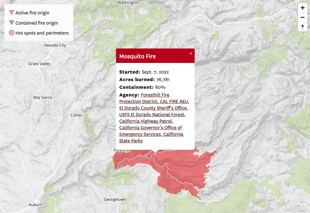
The San Francisco Chronicle has developed a California fire map that allows people to see in near real-time where wildfires are burning in the state. Of some important interest, past wildfires also show up, so a good understanding of trends and conditions can be realized.

Active fires can be selected, and an animated map will show the evolution of the fire, including the start date, acres burned, containment, and the responding agencies. For people that live in the WUI, this is an important and valuable wildfire preparedness and response tool.
Scroll to Top

Use of Cookies

We use “cookies” – including third-party cookies – to collect information about how visitors use the California Fire Prevention Organization website. Cookies help us give you the best possible experience, continually improve our sites and provide you with offers that are tailored to your interests.

The information collected via cookies can also be processed outside of the United States, for example in Canada or the EU.

By clicking the “Accept all” button you agree to the use of these cookies. You can withdraw your consent at any time.